Ottawa

Thus far travel has been uneventful, hope to keep it that way. Ottawa has been an eye opener. I remember driving through in our Corvette many, many years ago. I do not remember stopping. This time we have stopped for three nights slightly out of town, or more accurately in a part of town slightly away from the center of things.

We got in early enough to set up and relax before driving into the city late afternoon. We walked around the Rideau Canal locks

and looked at Parliament Hill and other sights such as the National War Memorial, before getting the car and returning to the coach for dinner and relaxation, we both have good books. We did book a two hour Free Walking Tour for the next day which provided a lot of information about the history of Canada and its government. I will not replay that here. Anyone who is interested can read any number of Canadian books on the subject. Don’t bother with books published in the US, we have way too many biases, or in other words you will miss the Canadian bias. As our guide said “What is it that unites Canadians? We are not America!” Following our tour and a late lunch we went into the Canadian National Gallery figuring we could spend a couple of hours there. We did and needed as much or more time to really see more of it, but mind, body and clock resulted in our leaving. We had spent the first 45 minutes or so in a fantastic exhibit of Canadian photography from the 1960’s to 2000. We then spent much of the remainder of our time exploring the modern era from the Impressionists (hardly modern I know) to work done in the past few years. We ran through earlier eras just to see what was represented there. 
As we  the drove toward the campground I pulled over to see Hogs Back Park where a dam was built in the 1820s to enable the construction of the Rideau Canal. We had to see the resulting falls and the locks

of the canal around them.

We stopped for dinner and returned to the coach to read and sleep.

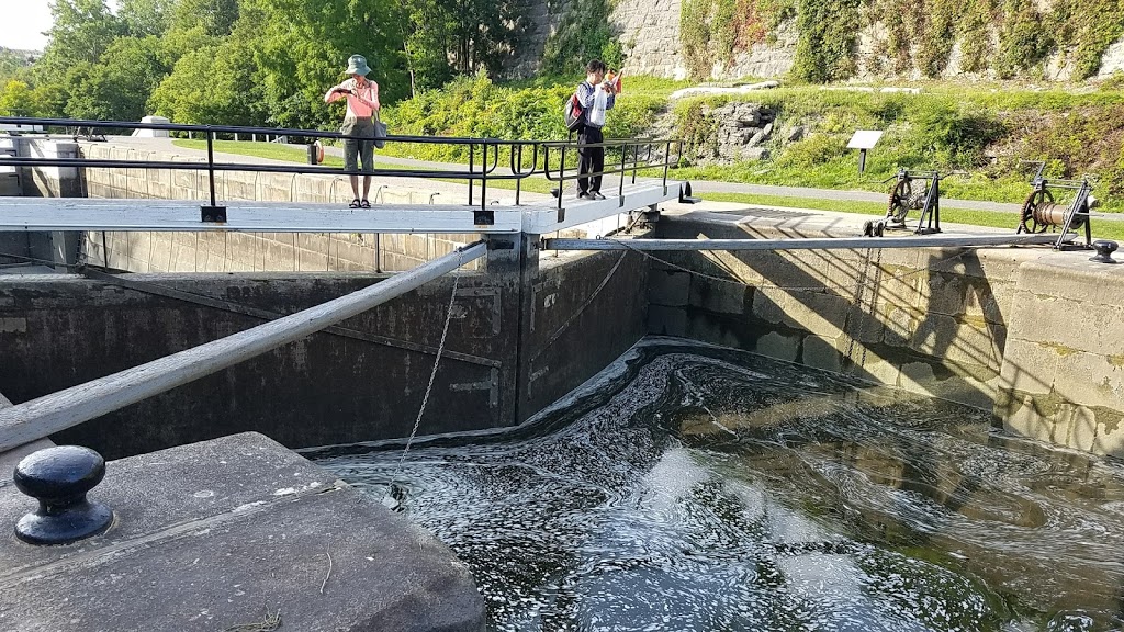
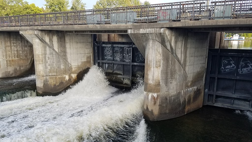
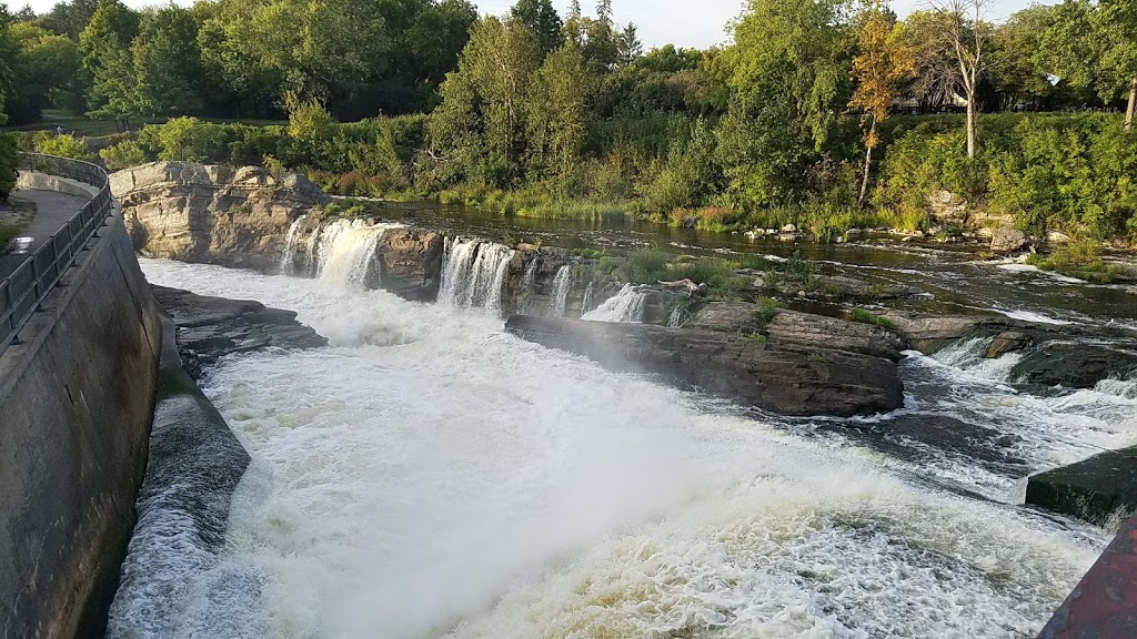
Today, our last day in Ottawa we stayed around the coach until after lunch then headed in to the National War Museum. I would think this is a must for anyone who does not know the history of Canada and how it relates to the US from pre revolutionary times through our Civil War. Even the construction of of the Rideau Canal plays a part in that story. The history following the Boer wars frankly was less interesting to me since Canada’s role while significant was a smaller part and is greatly magnified in the museum, as it should be.

Tomorrow Toronto and family time.

Montreal – Art/Montreal – Jazz

That pretty much says it all. We hit the ground running yesterday with a tour of several commercial galleries in Veiux Montreal then made tracks to Home of Jazz where we had seats at the bar facing the trio and a fine dinner. The trio was piano, drums and bass. Darn didn’t note the names before they scrolled off the web site. Click here to see the interior. It is loaded with all kinds of jazz memorabilia and “stuff”.

Today we returned to the city driving to the Metro station on the south side of the St Lawrence where we are staying and taking the Metro into town to the Musee d’Arte Contemporary. They are having a special exhibition reflecting the 50th anniversary of Expo 67. Carol and I were fascinated as we spent an extended weekend in Montreal when the Expo was on. Unfortunately most of my memory is of being cold and very wet, will have to review our slides of that period when we are in Rochester. The art we saw was current reflections by artists who were not even alive in 1967. We spent a couple of hours there and were exhausted when we fin ished. Sat down for lunch n the cafe and reflected on our memories of the time, Yechiel was 1 and Dan was not yet a gleam. We must have left Yechiel, then Joel, with Carol’s parents. Anyhow we were drawn out of the museum to the streets where activities surrounding the 4 day fashion show were happening.

Enough of that and we caught the Metro to the locale of the Musee de Beaux Arts and walked there from the stop giving us an up close view of another part of town. We were there until closing and most of our time was spent on the floor with art from the 20th century and contemporary work. We started with the older work with less than an hour to go and literally ran through the top three floors.

By five we were on the street on our way to a Metro stop to catch a bus to Diese Onze a small basement club where Taiwanese-Canadian guitarist Denis Chang was mostly playing bass with a couple of guitarists. He learned that one of the patrons played bass so they switched up with her on bass and Dennis on guitar. By the middle of the second set there were five musicians on stage (there was barely room for the three) and the piano had been uncovered and the lid raised so it could be included. All in all a lively jam session broke out. We exited before the second show, otherwise I couldn’t be writing this.

Uber to the Metro station, Metro back under the river and a 25 minute drive back to the campground. Tomorrow we have tickets for a walking tour on Jewish History of the Old City leaving from the Jewish Museum where I am sure we will start our day.

How to Plan a Long Trip

When we travel with OAT we leave the real planning to them and just figure out how to get on the plane in time. However as RVers getting to the plane on time can take some doing. Since we travel coast to coast regularly we have to decide where we are going to fly from and then figure what we will do with the coach while we are away. But, as always I ramble.

The question came up on a group of RVers about how to plan a multi week long distance trip. I started to write a response and decided to write it as a post here while we take a “do nothing” day in the coach outside Quebec City in lousy weather.

Planning starts with some goal be it “let’s see Newfoundland” or we want to be back in Jojoba Hills by the end of October. I have tried various specialty planning packages and none of them were written the way I think. First is the map. Well in our family’s life the map is always first for almost any discussion there must be a map. Next comes the “far point” or the place where we must turn around and go the other way. Then we fill in with wishes desires and most important people who we would like to see along the way. These people may be RVers whose plans we know or, easier, people with fixed residences. Finally dates we are committed to must be factored in. These could be ferry schedules, flights we have booked or family events. Last as almost an afterthought we get to where we will stay.

The route starts with a map such as Delorme Street Atlas, now defunct, which lets us set the route and build in normal travel days of 6 hours. This lets me see if we can actually fit in what we know we want to do and still not have excessive travel – it is a defined by us as more than two six hour days back to back. Looking at the daily stops and the possible side trips or deviations lets us build the schedule.
Finally I get out the camping resources that we like to use. First I start with Federal resources such as national parks/forests/monuments. There is Army Corp of Engineers, state parks, county parks and then I get out Days End which is a rich resource of free and inexpensive campsites across North America. Harvest Hosts offers wineries and agrotourism spots across the continent that are prepared to offer a night of camping for the price of a wine tasting or boat ride with alligators (we did that) or maybe the chance to buy fresh eggs and farm raised lamb. Resorting to campground review websites like rvparky.com and others brings together the possibilities for any given night. If it is not a weekend or not in the summer we often find ourselves making these decisions at 2 PM as we look for something interesting not to far from our route.

I will create a spread sheet with proposed stops and number of nights to see if it works and gets us where we must be and allows us to take a few days for us to do laundry, wash the coach, read a book. This is not a vacation, it is living and shopping and cleaning do have to fit in to the plan. If the plan sounds open ended that is because it is meant to be. We need to allow for serendipity and for aging bodies to rest.

We are in the midst of living such a plan as I write. As I mentioned we are taking a work day (we call it do nothing because we are not touring Quebec City as originally planned). We had two days of touring in chill and wet and a third such day did not appeal. Carol got to the laundry and I have messed around trying to get better service from our water heater – parts on order and our tire pressure monitoring system, parts on order. We have had a saga of small failures that have made life just a bit less comfortable than we would like. These too must be allowed for in any RV travel plan. We thoroughly enjoyed our time in Quebec City and are looking forward to Montreal where we have allowed three nights as well. We have the time, why not.

Crossing Nova Scotia and New Brunswick

Yes indeed we are on the move now. We stopped back at Arm of Gold in Little Bras D’or planning to stay two nights. The second night we joined the Perlmans for an art opening and dinner at Chanterell on the Cabot Trail. Wonderful meal and wonderful people. Did I say the ambiance was also wonderful? And the Perlmans bought, OMG how could it be better. During the day we had stopped at the Fossil Museum in Sydney Mines and had our eyes opened to the incredible fossil bed in the area, just above the coal seams. We extended our stay a day to join Stuart on a two hour fossil walk on the beach. We went to Aconi Point and walked out to the very point where a coal seam is exposed. Above the coal seam is a slightly later layer, 350 million years old! As Stuart pulled hunks of the layer down we flipped through the debris and almost every piece had at least one fossil impression of carbonaceous material, often on both sides, splitting a piece often resulted in two more fossil layers. we returned to the coach with far more rocks than we intended, but far less than most other participants.

Sunday we took our time getting underway, so what else is new, and crossed the rest of Nova Scotia on TCH 2 ending the day in Moncton NB at a casino that has a large RV parking area. We went in to the Casino to register and ended our visit to the interior in a matter of 5 minutes. I did “win” a deck of cards for registering. In the morning we dragged our heals again getting under way at about 10. We rolled down TCH 2 with the US border just a few miles to our west. We ended the day in Edmundston NB at another Casino. Unlike last night we seem to be alone here as far as other RVs. This is also a smaller casino. No entertainment during the week.

Again, no photos. The wonderful Verizon “unlimited” plan which includes data in Canada has a hidden limit – .5 GB per day! pictures just blow through that, especially uploading a day’s shooting for both of us. Even if VZW didn’t cramp our style, the service on Bell Alliant is so slow that 3G would look good, it’s the only reason we don’t blow through our daily limit by the time we are done with breakfast.

Quebec City tomorrow!

To the west and South of NFLD

Writing off line, trying to remember where I left off, there is little to no connectivity in Grand Codroy Tent and RV Park. That is the only problem with this otherwise delightful location.
Backing up a bit. We have driven the length of the Western Peninsula of Newfoundland from L’Anse aux Meadow in the north to Codroy Valley in two days. That is only 420 miles, but they are incredible miles with varied terrain and equally varied quality of road. We stopped overnight in Gros Morne at a KOA!! with the tightest site I have ever stuck the coach in. Once we opened the slides I could not walk around the coach to access any of my bays. Also, this is the first time I remember getting a site with water and no electric AND with very limited generator hours. Fortunately there was enough sky to light our solar array to keep the batteries topped up. We helped the batteries by going into Rocky Harbor for dinner and then to a Kitchen Party in the Pub. Lots of good fun until we decided to challenge the moose and get some sleep for another day of driving.
Before dinner we drove out to Norris Point and back to Lobster Cove. We just cannot get enough of roads that come to an end at the water. In Newfoundland that seems to be just about every road we get on. We have decided not to turn back, no matter how bad the road, until we get to the end. Fortunately the Jeep is the perfect vehicle for this kind of exploration. We try to keep the coach on main roads, but even those can get pretty rough and slowing to 20 mph on a highway is not uncommon to avoid opening every cabinet and dropping the clothes in the closet on the floor, again.
On our way south we noted that there was a zip line at Marble Mountain, about half way through our drive. We pulled in to their huge gravel parking lot after a few challenges finding the place. I must note here that signage is not something Newfoundlanders do well. Actually that is an understatement. As bad as the roads are, the signage could easily lead you to one of those roads that end at water. For example, the sign to Marble Zip Line pointed to the left. Naturally I turned left. I finally figured out that it meant GO STRAIGHT on the road to the left of the sign! Oh well we have always eventually ended up where we were going. (is that a tautology?) The zip line was a lot of fun, but regulation and liability concerns have taken a lot out of the excitement. There were two lines to connect to and the harness, normally a mountain climbing rig at the waist and around the legs was “enhanced” by a figure 8 upper body harness with an additional carabiner at the breast bone. This forced one into a seated or semi seated position with no way to lay out flat or upside down. For the fearful this is a wonderful setup. Carol and I felt restrained. The views as we soared across the gorge and the valley were worth it all. The 9th line was long and steep, they estimate top speed at 65 miles per hour! They made no attempt to stop us at the bottom, instead there are springs on the line to brake the descending person. Then they roll a stage into place to climb down from the line. I must note that while getting dressed I unconsciously chose my New Zealand ZipTrek T shirt. This caused some conversation with the staff. We will get on yet another zip line in the future I am sure.
I hope I can insert a picture or two of Carol on the line. They do not seem to have uploaded yet
Today we will tour by Jeep down to the Port aux Basque area and tomorrow we will take a day tour of the Codroy Valley where we are staying. Then Thursday we will get up early to be in line for the Ferry before 9:15 AM.
Another day without a connection in the coach 🙁 We indeed drove all the way to Rose Blanche, the very end of the road. It was a two lighthouse day because we also stopped to see Cape Ray as well. I guess I really shouldn’t be calling these lighthouses any more the Canadian Coast Guard has changed the label to Lightstation, oh well to me they are still lighthouses. The latter is located at the point closest to Nova Scotia, the southwestern extremity of Newfoundland. Here we found the cable end for the first underwater telegraph cable from Cape Ray to Baddeck NS. Also Marconi made one of his earliest long range wireless experiments from this station, before the telegraph company brought suit to stop him from setting up a commercial establishment. We got tangled up in Port aux Basque as our Garmin does not have the latest update and the roads have been reworked “recently”. It is really easy to get into the line for the ferry, the lanes are clear and even the signs are very good. NOT getting on the ferry is more difficult, especially of you want to get past Port aux Basque. TCH (that’s Trans Canadian Highway) 1 ends – or rather begins in Newfoundland – at the ferry. It ends in St Johns. Now we need to follow across to see the western terminus on Vancouver island. That is for another day.

Tomorrow we will tour the Codroy Valley following the very fine directions from the campground owner in her own publication. Carol will also take the opportunity to get her hair done, still doesn’t quite trust me with the clipper. Don;t know why, she does mine just fine. By the time you read this we will have rereunioned with the Perlmans Nova Scotia and be getting ready for the next legs Quebec City, Montreal, Ottawa, Toronto and Hamilton.  
More: We had an uneventful ferry ride back to Nova Scotia and settled back in to Arm of Gold for a couple of days. Turned into three nights but that is another story.

and We Keep Moving On

Left Gander for Twillingate. There is no way to happen on Twillingate it is at the far end of a 3 hour drive with no alternate but to come back almost the entire way. So what’s the draw? Another lighthouse, the possibility of seeing an iceberg or two – we saw one waaay off in the distance, museums and historic sites and the Split Peas. The most impressive historic site is the Beothuk Archaeological Site. The  Beothuk were a native group who survived until the 1800’s. This site goes back over 1,000 years showing that they were there well before the arrival of Europeans. The main building houses many artifacts and story boards depicting the site and the story of discovery. In the rain we set out on the trail to view the actual site from above. We were beset by mosquitoes as promised and the rain was no issue as we were prepared with rain gear. We returned to town and had dinner at My Cozy Tearoom, which is fine given the alternatives – few and slim pickin’s. Then on to Split Peas, seven women who have been singing together for 24 years, twice a week in season and on tour, in the past. It was a lot of fun, and someplace Carol has a photo of me dancing with one of the women dressed as a Mummer.

From Twillingate we set out on an intended long drive that got longer as our destination changed. We had planned a roadside overnight for midway through the drive to L’Anse Aux Meadow, where the first Viking colony in the New World was established. As it became apparent we would reach the site mid afternoon we decided to continue driving, beyond our planned 5 hours. Working the phone while Carol drove, I found a cancellation at a tiny campground in Cows Head in Gros Morne. Tiny as in 8 sites next to an equally tiny B&B. Here we sit facing the Gulf of St Lawrence with the wind at our back. To our left are two rigs with Canadians from Niagara Falls, ON and to our right is a nice Winnebago with NY plates from Tonawanda NY (between Buffalo and Niagara Falls NY), small world time!

Today we visited two more lighthouses, Cow Head and Lobster Cove, just outside Rocky Harbor. In between we took the Western Brook Pond boat tour. Any body of water is likely to be called a pond regardless of size, this one happens to be 16 miles long and over 600 feet deep. It is the defining locale of Gros Morne National Park. It is an inland freshwater fjord surrounded by towering cliffs forming a deep valley. The trip includes well done explanation of the geology and fun entertainment during the last part of the trip returning to the dock. Since the pond is well off the road and it is in the park, access is  by foot over a fairly level well maintained 3 kilometer (1.8 mile) trail (hmm, I typed trial first). that is entry and then exit after two hours on the boat. The trail took us about 35 minutes each way.

We set out to explore Rocky Harbor, about 22 kilometers further away from our campground and after visiting the lighthouse, it was clear the return drive would make for a very late dinner. We checked into TripAdvisor and found Java Jacks Gallery and Restaurant very highly rated. On approaching we were fearful we would not get a table as the parking lot was jammed. I found a parking spot while Carol got us a table. I had Cod Fillet and Carol had vegetarian Shepherds Pie. Together with wine it was a wonderful dinner and I will eventually rate them very highly on TripAdvisor.

Tomorrow we continue on to L’Anse Aux Meadow and a visit with some Vikings.

A Hodge Podge from the past week

A moment with connection and time to post at the same time. What follows is mostly a journal of the time since the last post. If you can;t read it all, read the last paragraph, today’s activities, it is brief and may even be touching.
In Golden Arm Park on the Baccalieu Loop in Avalon, NL. Our first stop today was at Rodrigeus Winery, a place of many surprises. All their wine is actually berry wine and it is sulfite free and most importantly it is kosher. The biggest surprise is that they are in the midst of changing their brand to Markland Cottage Wines. The signage was a bit disconcerting as we drove in and found the “wrong” name on the building. Given that we had just negotiated a narrow highway and an even more narrow and rutted dirt driveway in the motorhome on the promise that the place would be big rig friendly, it was a surprise. The last bad surprise, there was an easy way out and the staff are all Newfoundlanders which is to say friendly and easy to get along with. I sipped a bit of the tasting and bought a bottle of wine and we took the tour. Carol was driving and doesn’t taste anyhow.
Next we set out for a campground along the loop, ending up in Golden Arm Park in Green’s Harbor. It’s okay. Only 30 amp and the water pressure shows 20 psi on my gauge – way low. After setting up and lunch we set out to drive as much of the loop as we could in 5 hours. This was an overview as tomorrow we plan to leave early and stop at some recommended museums and sites. The drive went a bit long as we just had to explore roads that were 4 wheel drive only along the coast. One long road to Cape Grate took almost an hour to negotiate. A one point facing a puddle across the entire roadway Carol tried to convince me to turn back. I checked the depth with my hiking stick and decided to forge across. No big deal in the end. The Jeep has nice mud striping on the sides and will until we get some rain or I decide to wash it.
Our plan for Tuesday was to visit the key places we had passed and complete the loop. To that end we got a sort of early start after I had an unsuccessful wrestling match with Dish, to be concluded when I have reasonable phone service and 30 minutes to waste. Our first stop was Heart’s Content, the place where the very first Transatlantic Cable came ashore. The station was in operation for almost 100 years. In 1965 the staff had reduced to 18 from over 300 at the high point, this was first due to increasing automation and then to ever decreasing traffic as new lines and telephone cables changed the nature of communication and eliminated the need for telegraph transmission. When the time came Western Union switched off the power, locked the doors and walked away. The entire complex came into the hands of the Provincial government which has preserved it and reopened it as an historic site. You can still see where the undersea cable comes ashore and where it enters the building underground. For
Rochesterians there is a direct connection as Hiram Sibley founded Western Union and it was headquartered in Rochester for a time.
Our next stop took us back further in time to The Boat Building Museum in Winterton. We spent an hour there touring the history of wooden boats in Canada and Newfoundland and Labrador in particular. The most interesting thing I learned is that the method of laying out wooden hulls using variable frames is very rare in the boat building world. I won’t even try to explain as I have not spent a lifetime learning the technique. Suffice it to say a Venetian gondola builder was surprised to see them using the method that he thought was exclusive to them.
We moved on heading for the extreme ends of the road to the north. Our last stop was Bay de Verde Where another historic site has been preserved. This is the home of a Merchant fisherman, named John Blundon. Across from Bay de Verde is Baccalieu Island Ecological Reserve where thousands of Leaches Storm Petrels roost. We left there and slowly returned down the east coast of the peninsula covering new territory as we went. In Carbonear we looked for a place for dinner and found that most were closed on Monday and Tuesday night. The only place we could find was Main St Diner. It is a Tripadvisor 2 star (in a town where Subway is 4 star). I certainly would not rate it any higher. We drove through the dusk returning to the coach. I say that because all advice says not to be on the road after dusk as that is when the moose are moving.
Oops, skipped a day. From Golden Arm CG (not Arm of Gold CG) we drove to Golden Sands Campground on The Burin Peninsula. We explored from there aroung the loop through Grand Bank and St Lawerence. In Grand Bank we attended theater, twice! The first night we dined at the Thorndyke Inn, not to be missed and saw Love Letters with a cast of 2 and audience of 12. We really enjoyed the perfomance and were glad to be coming back for Dinner Theater the following night for “ps The Cat Is Dead” During the intervening day we toured and stopped at several light houses. The most poinient stop was in St Lawrence at the Miners Museum and Memorial. The story of the mistreatment of miners, in this case fluorite mining, is nothing new and the lung disease is also brutal. Our docent is the daughter of one of the miners. The other story is the heroic rescue of US Sailors from the Truxton and Pollux which ran onto the rocks during WWII and broke up with loss of about half their combined crew. The rest were saved by a valiant effort of Bergeron who having achieved the high ground found his way to a mine where the miners turned out with the entire town to pull the survivors from the sea and up the very high cliffs to eventual safety. We drove and walked to the spot on Chamber Cove where the men were rescued and find it hard to believ that even in good health on a calm sunny day that the cliffs were climbable.
Moved out in the morning headed toward Bonvista at the northern extreme of the Eastern Area. We needed some facilities and started looking for a campground, forgetting that it was Friday night and every town is having a festival or “Come Home Year” reunion. Found a site for one night in “no place” and dropped the coach with a brief setup and set out to explore Trinity and surrounds not more than 40 kilometers up the road. We drove out to Fort Point Lighthouse and explored there, it was after hours and the entry gate was “locked”. They had tied a loose twine loop over the gate to keep it from swinging in the wind. Then we drove back into Trinity a very old fishing town for a look around. There was a suggested boondocking site in town and we were grateful we had not tried to get there. The streets are very narrow and twisty and they were congested when we arrived. The boondocking site was now clearly marked “No overnight parking”.
Today, Aug 6 (?!?!) we are planning our last 10 days already 🙁 Drove to Gander and changed into my “Come From Away” T shirt. No one noticed, well one police officer, O. Fudge, did. He or more likely his relative is featured in the play. Writing on speeding warning tickets STFD. We went to the National Aviation Museum and learned the history of the Gander Airport and more of the story of Sept 11, 2001. As we were viewing the exhibits we came upon one that almost reduced us to tears. In December 1985 Arrow Airline, a contractor to the UN returning soldiers from the 101 Airborne from a peacekeeping mission, crashed off the end of the runway here. Our next door neighbor’s son Peter Schremp was among those killed in that crash. He and his siblings played endlessly with out boys as they grew up until we moved away. We drove out to the Silent Memorial and remembered Peter and his family and thought of the many families who lost loved ones on that day.